ERDC/CHL CHETN-I-68
March 2004
Horizontal coordinate systems supported within SMS are: (a) geographic, (b) State Plane,
(c) Universal Transverse Mercator (UTM), and (d) NAD 27/83/HPGN coordinates in meters,
U.S. survey feet, or international feet. Geographic coordinate systems consist of latitude, longitude,
and height measurements, with the prime meridian and the equator as reference planes to define
latitude and longitude. The State Plane System was developed in the United States in the1930's to
provide a national datum and was based on the North American Datum 1927 (NAD 27), with
coordinates in feet. In 1983 the NAD 27 was superseded by the NAD 83 system with units in meters.
Smaller states may have only one zone, where larger states may be divided into several zones. UTM
coordinates are composed of UTM zone numbers designating 6-deg longitudinal strips and UTM
zone characters designating 8-deg latitude zones. Vertical coordinate systems support NGVD 29 or
NAVD 88 in meters, U.S. survey feet, or international feet. The mean low low water (mllw) datum is
usually used. These conversions also make sure all data is aligned according to true north.
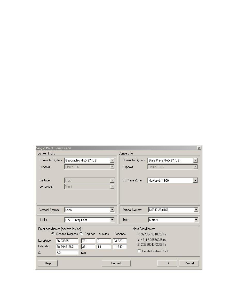
Figure 4 is an example of a single point conversion within SMS for the offshore directional
NORTEK Aquadopp wave gauge used in the field measurements at Tedious Creek during April to
July 2001. Water depth was 2.3 m (7.5 ft). The gauge was located at lat. 38.24482 and long.
76.03995. Click on the Edit|Single Point Conversions command to open the conversion routine.
Values can be input in decimal degrees or in degrees, minutes, and seconds. The input and output
horizontal systems are geographic NAD 27 (US) and State Plane NAD 27 (US), respectively. The
output State Plane Zone is Maryland 1900. These can be determined using the Help menu and
Figure 4.
Single point coordinate conversion
6


 Previous Page
