
ERDC/CHL CHETN-I-68
March 2004
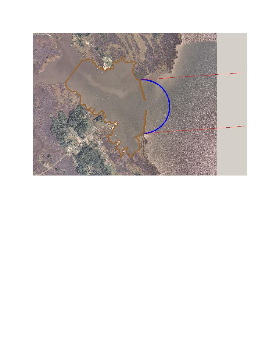
Figure 5.
CGWAVE model boundary for Tedious Creek, MD
You can further define the area being studied by creating additional feature arcs. This is done using
the Create Feature Arc tool in the Map module. The Tedious Creek model has a feature arc at each
major change in direction along the coastline boundary. In the vicinity of the public piers, there are
many arcs to properly define the piers. The coastline arc near the piers was broken into several
unique arcs and vertices were moved to follow the exact layout of the piers (see section on
"Reflection Coefficients").
1-D transects. The 1-D lines are used to transform offshore wave data to the ocean boundary of
the model to increase the reliability of the model's predictions in projects where exterior bathymetric
effects might play an important role. In cases where 1-D transformation is used, it will no longer be
necessary to use other spectral wave models to transform waves from deep water. The CGWAVE
model uses a 1-D mild slope wave equation to solve for the wave transformation from an offshore
point with known wave climate to the CGWAVE semicircular ocean boundary. The assumption is
that the bathymetry only changes in the offshore direction seaward of the ocean boundary; thus,
simplifying the calculations.
A 1-D transect extends offshore from each side of the model domain (Figure 1 and Figure 5) with
origin at the intersection of the semicircular boundary and the coastline boundary. Since the ocean
boundary is curved, the values of wave transformation are input from the transect which is closest to
the point along the semicircular boundary. Near the center, the values are averaged between the two
transects. Each transect includes bottom friction and reflection, if these processes are activated. It is
8

 Previous Page
