
ERDC/CHL CHETN-I-69
March 2005
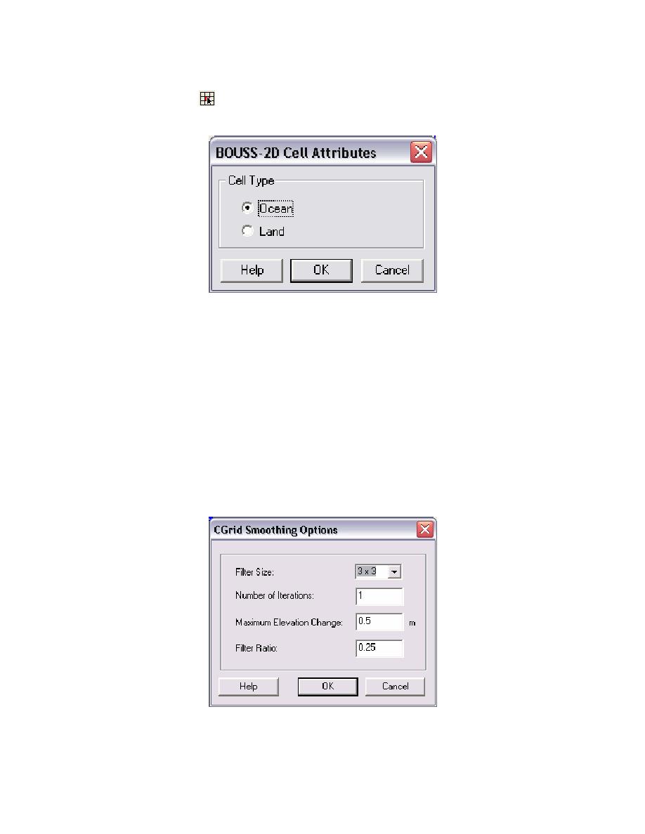
(2) Classification of node point as land or water. This is done by selecting one or more nodes
using the select cell tool
and specifying the cell attributes using the Assign Cell Attributes com-
mand in the BOUSS-2D menu. This brings up the BOUSS-2D Cell Attributes dialog.
Figure 5. BOUSS-2D Cell Attributes dialog
(3) Smoothing bathymetric data in the grid. The Cartesian grid (CGRID) Smoothing Options
dialog (Figure 6) is available when there is an active grid. To access the dialog, select Data |
Smoothing Options... from the menu bar. The two choices for the Filter Size: (3x3 and 5x5) refer to
the subgrid size that the smoothing utility will use. The cell in the center of the subgrid is checked
against all the other cells in the subgrid to determine if it needs to be smoothed. The Number of
Iterations assigns the amount of times the smoothing utility will loop through the cells. The
Maximum Elevation Change sets the property that the difference in elevation between a cell and any
of the cells that surround it (depending on the filter size) will be no larger than the value entered in
this field. The Filter Ratio ranges from 0.00 to 1.00, and it represents the percentage of filtering.
Smoothing bathymetric data may sometimes be necessary, but in general its usage requires careful
consideration of the filtering schemes used since the smoothed bathymetry can be substantially
different from the original.
Figure 6. Smoothing Options dialog
7

 Previous Page
