
ERDC/CHL CHETN-I-69
March 2005
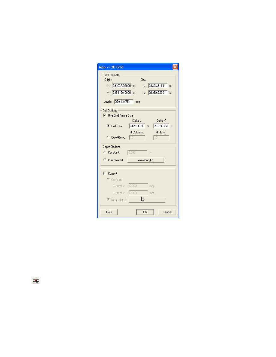
created. Bathymetry values for each node of the grid will be interpolated from the scattered
bathymetry data at the node locations. Grid cells with a positive bathymetry value will be classified
as dry land and excluded in the BOUSS-2D calculation of waves. After the grid is created, the user
can also select nodes and modify bathymetry values and cell classifications.
Figure 4. Map ->2D Grid dialog
d. Editing a grid: The BOUSS-2D grid may be edited, but the grid itself cannot be reposi-
tioned. To reposition a grid, a new grid should be created. This is required if the domain needs to be
enlarged or reduced, the grid cell size needs to be modified, or the grid orientation needs to be
adjusted to align better with principal wave directions. Various operations are permitted for editing a
BOUSS-2D grid. These include:
(1) Specification of individual node elevation. Select one or more nodes using the select cell tool
, and specify a elevation value in the edit field located at the top of the dialog box. This feature
could be used, for example, to evaluate the effects of a dredging operation on the wave field by
deepening parts of a navigation channel or describing dredged material mounds in the modeling
domain, etc. This feature is useful when some changes to the underlying bathymetry are desired in a
small part of the modeling domain where such changes can be made manually to a subarea or
selection of cells.
6

 Previous Page
