
ERDC/CHL CHETN-II-47
March 2004
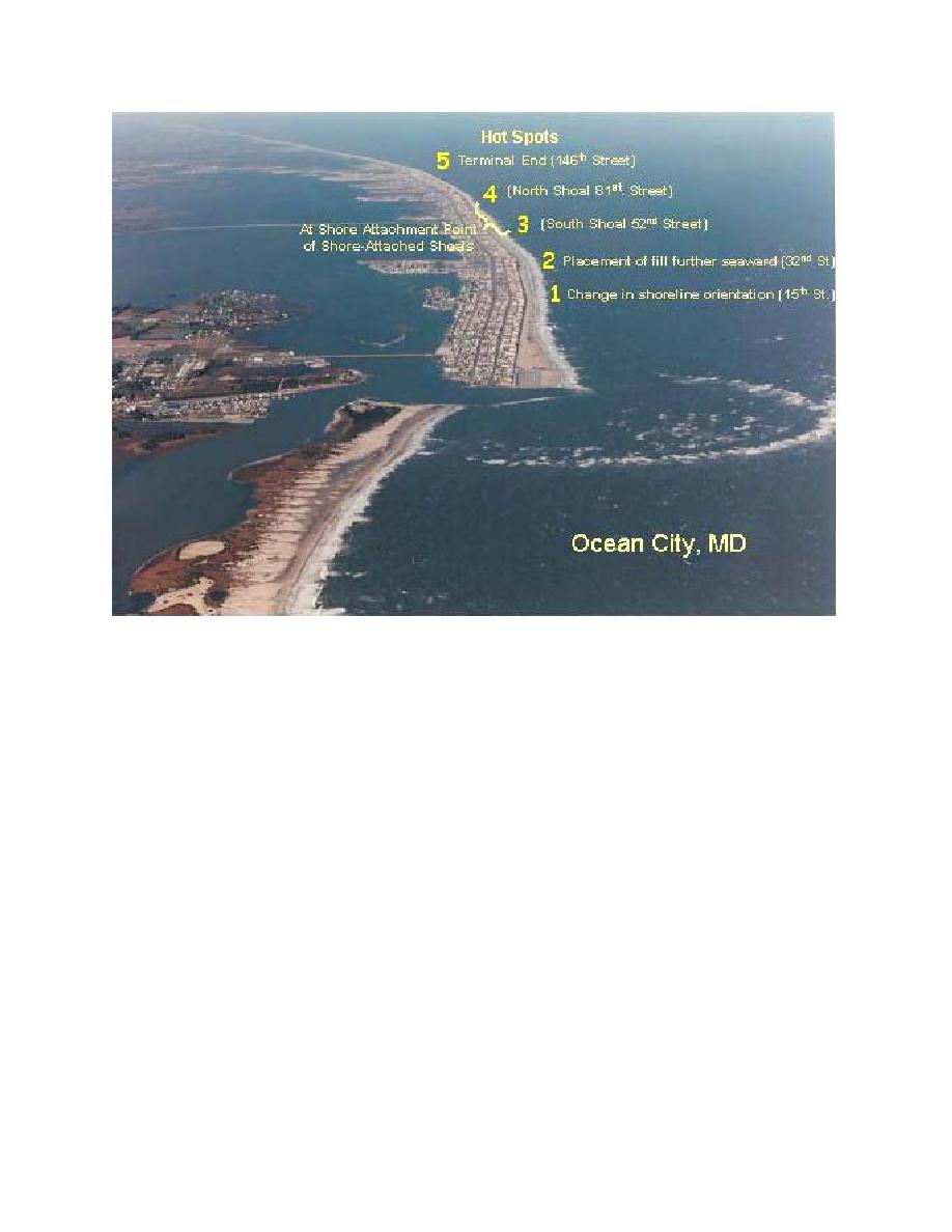
Figure 8.
Location of the five hot spots along Atlantic coast of Maryland (Ocean City) Shoreline
Protection project (Stauble and Bass 1999)
with each renourishment this hot spot area lost less sand volume. The 32nd Street hot spot was
caused by a seaward encroachment of the upland property onto the beach requiring fill to be placed
seaward of the adjacent beaches to maintain the design requirement of a uniform fill template. As
more sand was retained on the profile with each successive fill this hot spot area has also become
less of a problem. The hot spots at 52nd and 81st Streets are suspected to be a function of wave
focusing at the landward end of two shore-attached shoals. End loss at the northern terminal end of
the project at 146th Street is the location of the final hot spot. Overfilling the hot spot areas and back
passing sand by truck from the inlet area have been the remedial steps taken. These areas have
required 49 percent of the total fill volume placed. Sand eroded from these hot spots has been
deposited in a series of "cold spots" where excess sand volume was measured above the fill volume
placed and the shoreline is consistently seaward of the adjacent areas (Figure 9). These cold spots
suggest a complex 3-D sediment transport mechanism between the hot and cold spots. Even with the
high frequency of storms, there has been no upland structure damage since the project inception in
1988. The fill volume requirements have also decreased over time with the renourishment now
focused only in the hot spot areas.
11

 Previous Page
