
ERDC/CHL CHETN-II-47
March 2004
Ocean City, NJ. The Great Egg Harbor Inlet and Pecks Beach Shore protection project is located
on the northern end of Pecks Beach, a barrier island along the southern New Jersey Atlantic coast.
The town of Ocean City occupies the island and the project extends from the Great Egg Harbor Inlet
shore at Seaview Road on the north to 36th Street on the south. The State of New Jersey has placed
beach fill on the rest of the island's beaches south to 59th Street. Net drift is from north to south. A
beach nourishment project was first constructed in 1952 and renourishments have been performed by
both Federal and local efforts since that time. The latest Federal project was initiated with Phase I in
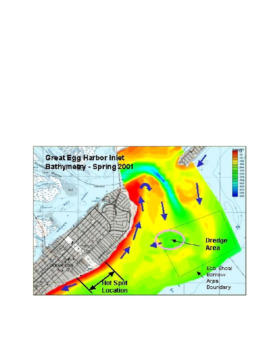
1992, with the latest renourishment in 2000. A hot spot developed between 5th and 9th Streets in the
center of the downtown urban area (Figure 6). Pecks Beach is a drumstick barrier island (Hayes
1979) and the hot spot area corresponds with the widest part of the island. It is just downdrift of the
ebb shoal attachment point. The borrow area is located on the southwest corner of the ebb shoal
within about 2,438 m (8,000 ft) of the beach. Typical of drumstick barriers, a local drift reversal is
present most likely caused by wave refraction over the ebb shoal and resulting in net longshore drift
to the northeast into the inlet from the hot spot area (as well as southwest on the downdrift side of
the hot spot). The close proximity of the borrow area to the shore may also have affected the ability
of the inlet to naturally bypass material that previously maintained the bulbous morphology at this
end of the island.
Figure 6.
Location of hot spot area, designated borrow area with dredged area on western edge and
suspected longshore circulation at Great Egg Harbor Inlet, NJ (courtesy of Monica Chasten
and Rob Lowinski, Philadelphia District)
9

 Previous Page
