ERDC/CHL CHETN-II-47
March 2004
has been constructed to the south of the project to protect Fort Fisher and this structure's end effects
may also influence the hot spot.
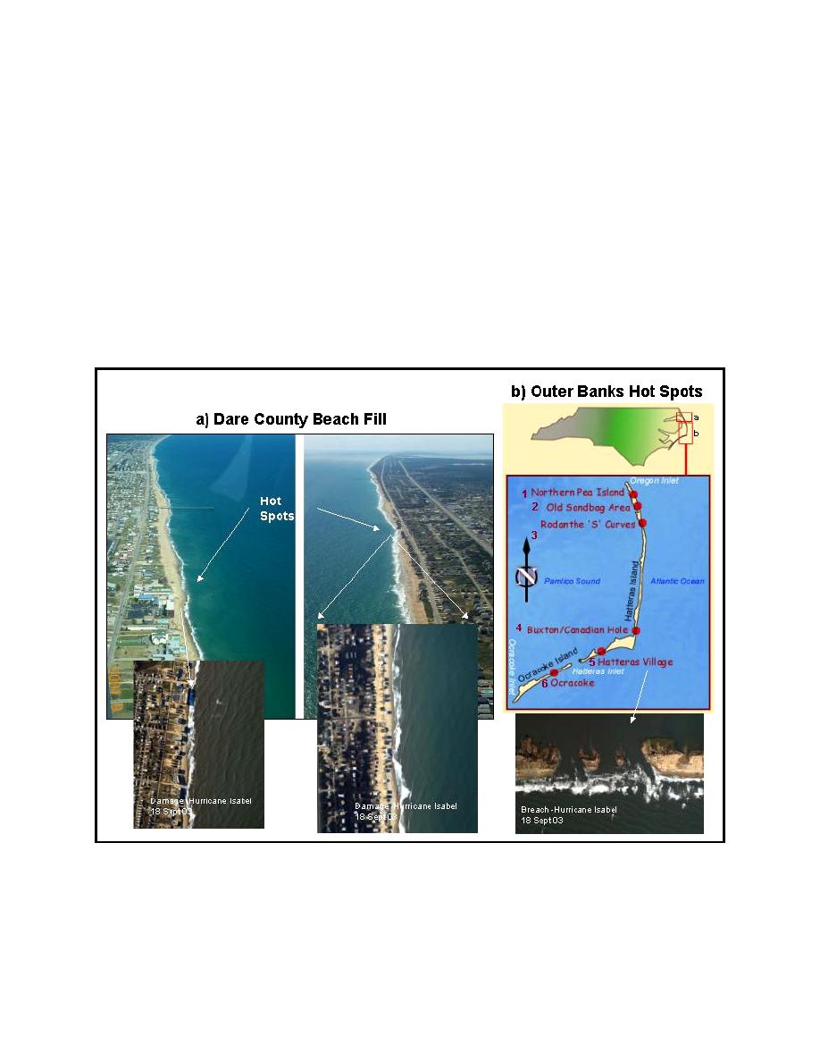
The Dare County nourishment project is proposed to fill two sections of eroding coast in the
northern part of the state. Within the project area are two persistent hot spots. One hot spot is along
the Beach Road in Kitty Hawk, where many houses have been lost. A sand bag revetment/seawall
was constructed to protect the road until the fill can be placed. The second area is in Kill Devil Hills
(Figure 11a). A poorly understood hot spot is also located in South Nags Head. The two main areas
are currently being studied. They have known geologic influences with limited normal coastal sand
overlying a silt/clay bed (old river channel). Nearshore shoals, on a 45-deg angle to the coast, also
influence the wave focusing on the hot spot areas. Both of these hot spot areas experienced overwash
with extensive structural and dune damage as a result of the passage of Hurricane Isabel in
September 2003.
Figure 11. Hot spot locations: (a) along Dare County, NC coast (courtesy of William Birkemeier, CHL),
and (b) Outer Banks (courtesy of John McCormick, Wilmington District), showing overwash
and inlet breach at hot spot locations resulting from Hurricane Isabel (NCDOT)
14


 Previous Page
