
ERDC/CHL CHETN-I-70
May 2005
There is now a surface that represents the seabed around the region of Barbers Point Harbor in
Hawaii. The next step is to create a computational grid for BOUSS-2D.
Create Grid: The computational domain of BOUSS-2D is a Cartesian grid that can be defined with
three clicks. In this example, instructions are provided to ensure consistency. To create the grid,
follow these steps:
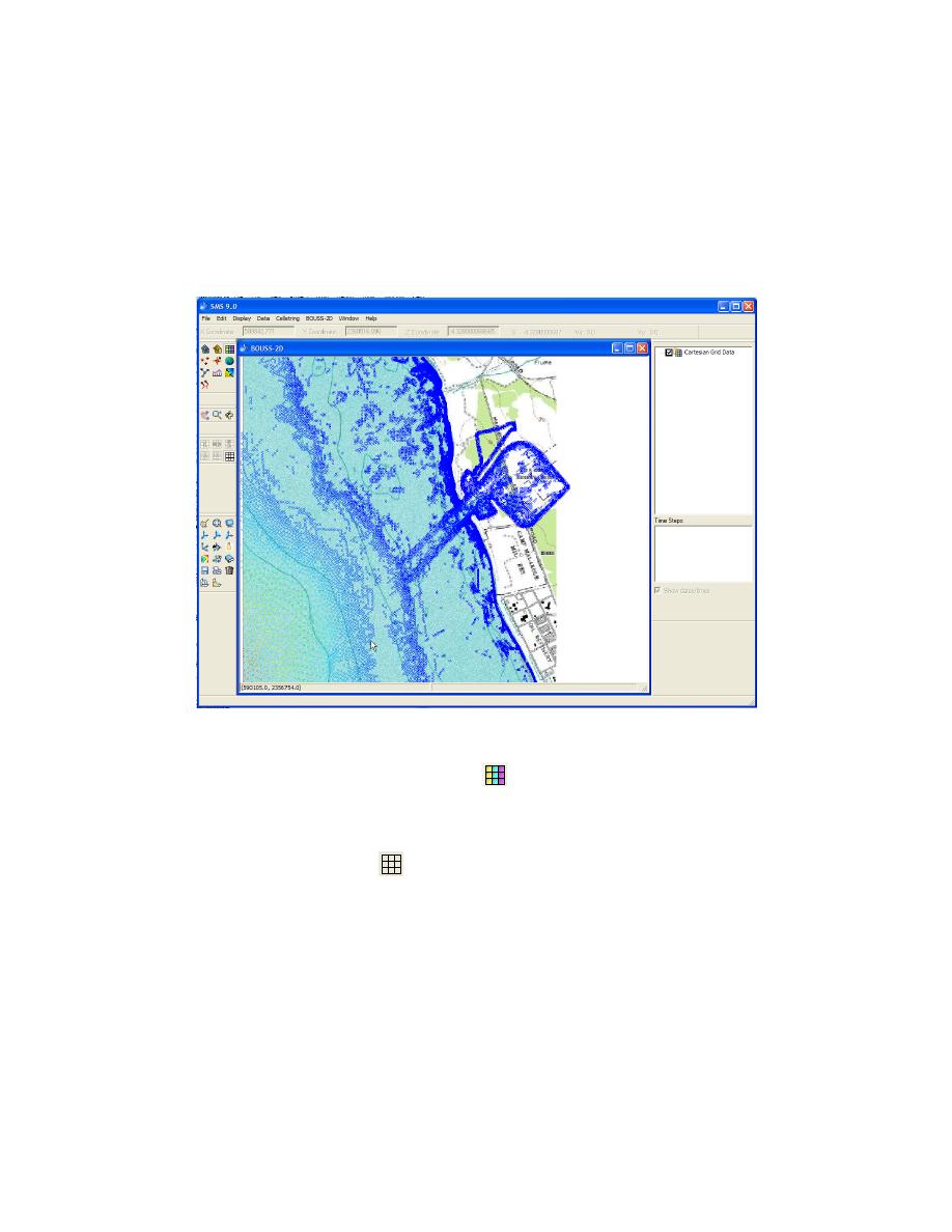
a. Zoom into harbor as shown in Figure 6.
Figure 6. Zoomed view displaying area for creating computational grid
b. Make sure the 2D Cartesian Grid Module
is the current module and that BOUSS-2D is
the active model. User should see a BOUSS-2D menu at the top menu bar in SMS. If this is
not the case, select Data|Switch Current Model and select BOUSS-2D.
c. Select the Create Grid tool
- Click near the point P1 (Figure 7). An exact location of
points can be specified later. The coordinates of the cursor are displayed on the lower left
corner of the window.
d. Move the mouse toward shore and inland. At the bottom of the window, the size of resulting
grid is displayed. Click on point P2 (Figure 7), approximately 2,500 m from the first point.
e. Move the mouse up to include harbor approximately 2,000 m from second point and click in
the area of point P3 (Figure 7).
6

 Previous Page
