
ERDC/CHL CHETN-III-66
June 2003
The August 2002 photogrammetric survey of the breakwater revealed negligible movement of the
concrete armor units relative to the 1996 survey. Maximum movement of the targets established on
the tribar armor units in the horizontal and vertical directions, respectively, were 0.14 m (0.45 ft) and
0.106 m (0.35 ft); and the average movements of all horizontal and vertical targets were 0.012 m
(0.04 ft) and 0.021 m (0.07 ft), respectively. Maximum movements of the target armor unit
centroids were 0.088 m (0.29 ft) and 0.073 m (0.24 ft) in the horizontal and vertical directions,
respectively, while average movements were 0.012 m (0.04 ft) and 0.024 m (0.08 ft) in the
horizontal and vertical directions. Seventy-three percent of all vertical movements and 93 percent of
horizontal movements were 0.03048 m (0.1 ft) or less. Changes in rotation angles of the armor units
varied from 0.0 to 4.03 deg with an average of 0.64 deg. A walking inspection of the structure in
2002 revealed no broken tribars. Fifteen sea-side tribars were slightly separated from the rib cap as
opposed to one in 1996. On the entire sea side of the structure, it was noted that the Swiss cheese
block underlayer units had separated along the slope between the third and fourth rows (down from
the crest). Typical separations ranged from 2.54 to 10.16 cm (1 to 4 in.), and the maximum was
20.32 cm (8 in.). Some underlayer separations 2.54 to 10.16 cm (1 to 4 in.) were also noted on the
harbor side of the structure. Separations between the cheese block underlayer units were more
widespread as opposed to the 1996 inspection. The 510.29-kg (1,125-lb) high-strength concrete
underlayer units around the head of the structure looked the same as the previous inspection. Even
though slight movement in the breakwater's underlayer armor units had occurred, the breakwater
appeared to be in excellent condition. It has not been subjected, however, to a major tropical storm,
typhoon, or hurricane since its construction.
NAWILIWILI HARBOR BREAKWATER, KAUAI, HI: Nawiliwili Harbor is located on the
southeast coast of the island of Kauai. It is protected by a 624.84-m- (2,050-ft-) long breakwater.
Constructed in 1922, the breakwater has had a long history of repair. The most recent rehabilitation
occurred in 1987. Base conditions were established in 1995 for the outer 259.08 m (850 ft) of the
breakwater (Bottin and Boc 1996) under the "Periodic Inspections" work unit of the MCNP
Program. The structure was revisited in 2001 (Bottin and Meyers 2002a).
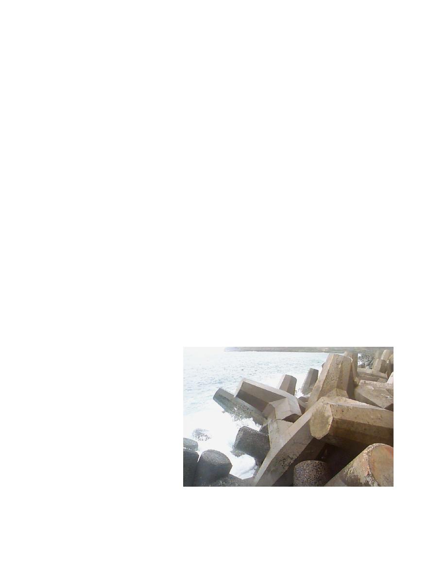
Originally constructed with stone
armor, the outer portion of the
breakwater was later armored with
several sizes of dolos and tribar con-
crete armor units 9,979.03- and
20,865.25-kg- (11- and 23-ton)
dolos,
and
5,896.70-
and
16,147.89-kg (6.5- and 17.8-ton)
tribars). It includes a concrete rib
cap that provides buttressing for the
armor and access along its align-
ment. The structure has a crest el of
+4.88 m (+16 ft). Side slopes along
the sea-side slope and the trunk
(Figure 2) are 1V:2H, and slopes on
the harbor side of the breakwater are Figure 2. Trunk of Nawiliwili breakwater
1V:1.5H. In general, the sea-side
3

 Previous Page
