CETN III-46
(3/92)
(horizontal).
The crest elevation varies from 33 to 36 ft mean lower low
water (MLLW) and the toe is at approximately 11 ft MLLW. Two different walls
meet at Site No. 2, North Beach Drive (Figure 3). Upcoast is an BOO-ft long
rubble mound type structure with core stone and filter fabrics. The crest
ranges from 12 to 15 ft MLLW.
Immediately downcoast is a 650 ft wooden
bulkhead with curved concrete cap and crest of 16.6 ft MLLW. Site No. 3,
South Beach Drive, is a 410-ft long rubble mound wall (Figure 4) randomly
placed without core stone and filter fabrics. Mound crest is at 16.6 ft MLLW.
Site No. 4 at South Aptos Seascape (Figure 5) is a 980 ft curved concrete
seawall of 21 ft MLLW crest with stone toe protection. Except at Site No.1,
the beaches are all of relatively moderate width with gentle offshore slopes.
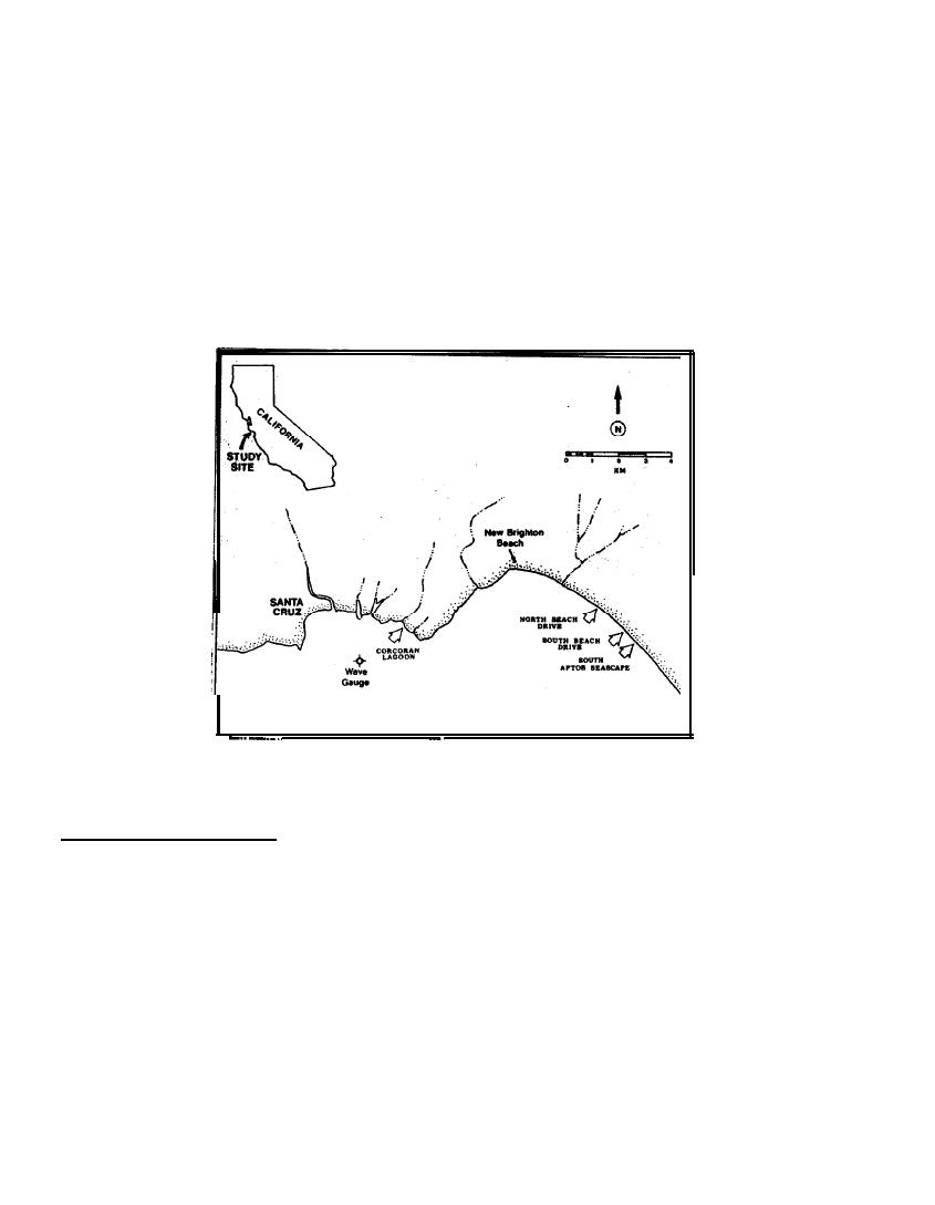
Figure 1.
Locations
of
Monitoring
Sites
SIGNIFICANT FINDINGS:
All changes in beach profiles were temporary or
seasonal, and develop during the transition between summer swell and winter
storm conditions.
Regarding cross-shore transport, no long-term differences
were observed between armored shorelines and unarmored-control areas. In some
instances longshore transport appeared to be affected and signs of sediment
deprivation were observed downdrift of the structure. The following are the
conclusions by Griggs, et al (1990a) and Griggs (1990b) derived from a 4-year
field monitoring study at the coast along northern Monterey Bay.
a. With the arrival of winter waves, the loss of the summer berms
occurred sooner in front of all monitored seawalls than in front of the
adjacent unstructured beaches.
b . The berm may or may not be removed sooner in front of an impermeable
vertical wall when abutted by a sloping permeable wall.'
c. After the winter profile has been established, there is no significant
or consistent difference between the beach face fronting permeable structures
and impermeable walls.
3


 Previous Page
