
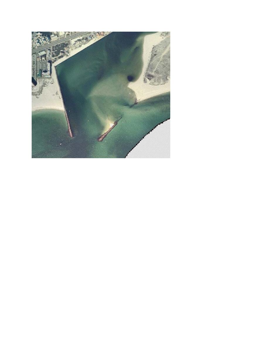
Figure 3. Perdido Pass, FL, February 2003, with spit on right side
protruding into the channel behind the weir jetty
MECHANICAL BREACH CLOSURE: This section compiles selected experiences with
breach closure operations and the lessons learned at these sites.
Bayocean Peninsula, Oregon. The Bayocean Peninsula is located approximately 80 miles
west of Portland, OR, and about 50 miles south of the mouth of the Columbia River. The
peninsula is a spit formed across the mouth of Tillamook Bay. A small inlet at the north end of
the spit connected Tillamook Bay with the Pacific Ocean. In 1917, a jetty was constructed on
the north side of the entrance to provide a reliable navigation channel. By the late 1920s, erosion
was apparent along the peninsula and continued at a rate of approximately 20 ft/year until
November 1952, when a storm breached the barrier at its narrowest and lowest point. The
breach transported large volumes of sand into the bay, and large wing spits formed on both the
north and south breach banks.
The breach reduced tidal current velocity through the inlet, which caused shoaling in the
navigation channel and made navigation hazardous. Sand eroded from and transported through
the breach covered the mud flats in the bay where oysters were grown. The breach also resulted
in higher bay water levels, which overtopped farming dikes. In response, the U.S. Army
Engineer District, Portland, was authorized by Congress in 1954 to close the breach. In 1953,
the breach was wide and shallow, estimated to require only a dredged sand fill to close it.
However, by 1955, when planning for the work began, the breach had deepened to about 13 ft,
5

 Previous Page
