ERDC/CHL CETN-IV-24
March 2000
is typically positioned in the study area to record atmospheric pressure changes. This allows
water level data to be corrected for changes in the barometric pressure. Some of these
instruments have the capability of measuring water temperature, conductivity, and dissolved
oxygen concentrations, as well as water level elevation. The recording interval, frequency, and
sampling rate vary depending on the needs of the project. When deploying tide gauges, it is
essential to establish a datum to reference the changes in the water level. If the gauge cannot be
leveled to a land-based vertical datum, then longer periods of record are needed to establish a
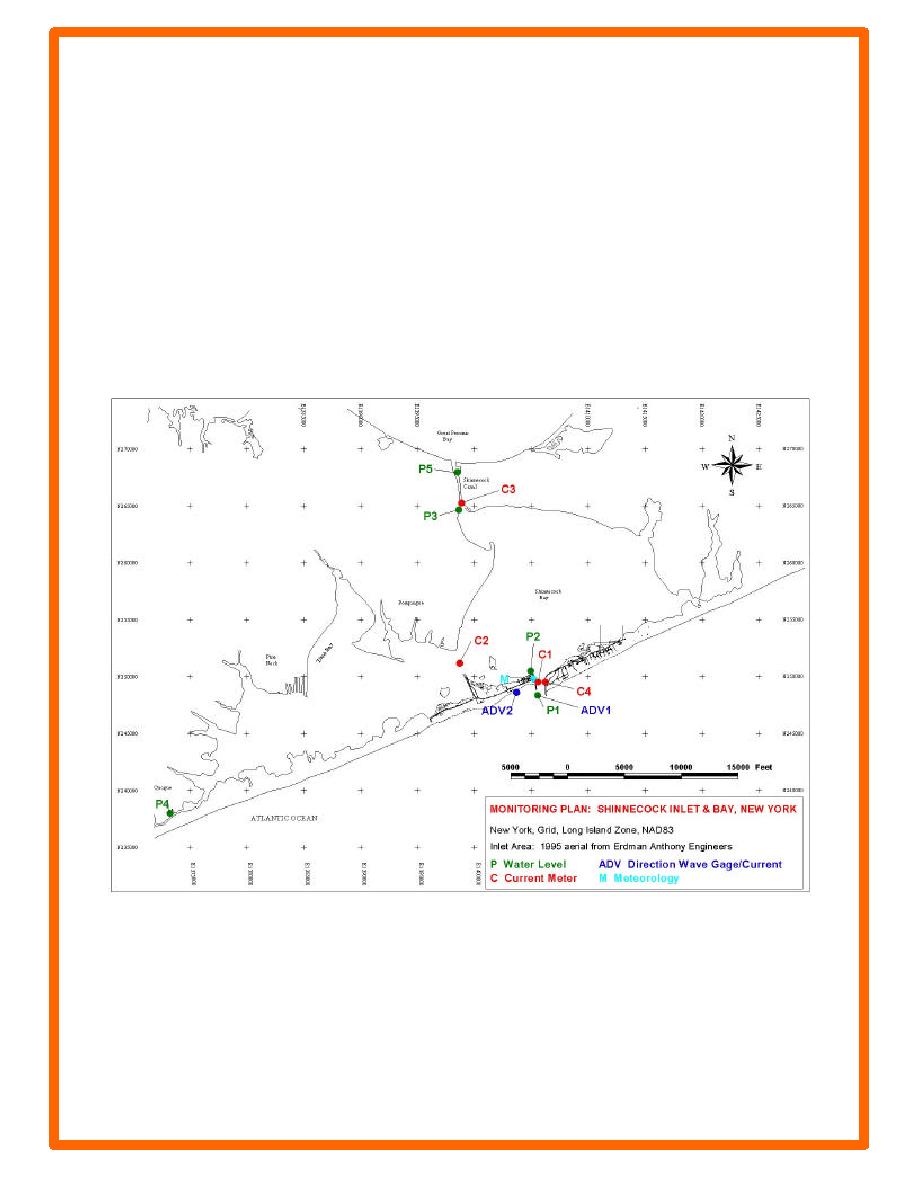
mean sea level value for the site. Figure 1 is an example measurement plan showing the
locations of instruments for a long-term study at Shinnecock Inlet on Long Island, NY. These
locations were chosen in support of a hydrodynamic modeling study of inlet processes. All of
the model boundary conditions, waves, winds, water levels and currents were measured with this
instrument configuration.
Figure 1. Shinnecock Inlet monitoring plan, Long Island, NY
The locations beginning with a "P" represent water level measurement points. The locations
beginning with a "C" represent fix point current meter locations. The "ADV" locations measure
water levels, currents and waves. The meteorological station was labeled "M" in this plan.
5


 Previous Page
