ERDC/CHL CETN II-43
June 2000
In situations where the sonar cannot interpret the reflected signals (typically near shore where
bubbles interfere with the acoustic signal) other methods to locate the sediment bed/water
interface may be employed. For the STORM experiments, a secondary method for estimating
bottom location was by the identification of buried OBS. By identifying the depth of buried
OBS, relative distances from the seabed to other instruments could be estimated. In cases where
there was no sonar lock and no OBS were buried, sediment transport was not estimated.
VERTICALLY INTEGRATED UNIT TRANSPORT: Discrete values of concentration,
elevation, and velocity must be integrated over time and in the vertical direction to provide
sediment transport rate per unit width in the longshore direction. One method for performing
these calculations is to discretize concentration into individual vertical bins, with bin boundaries
located midway between OBS locations. The lower bin bottom boundary will be the sediment
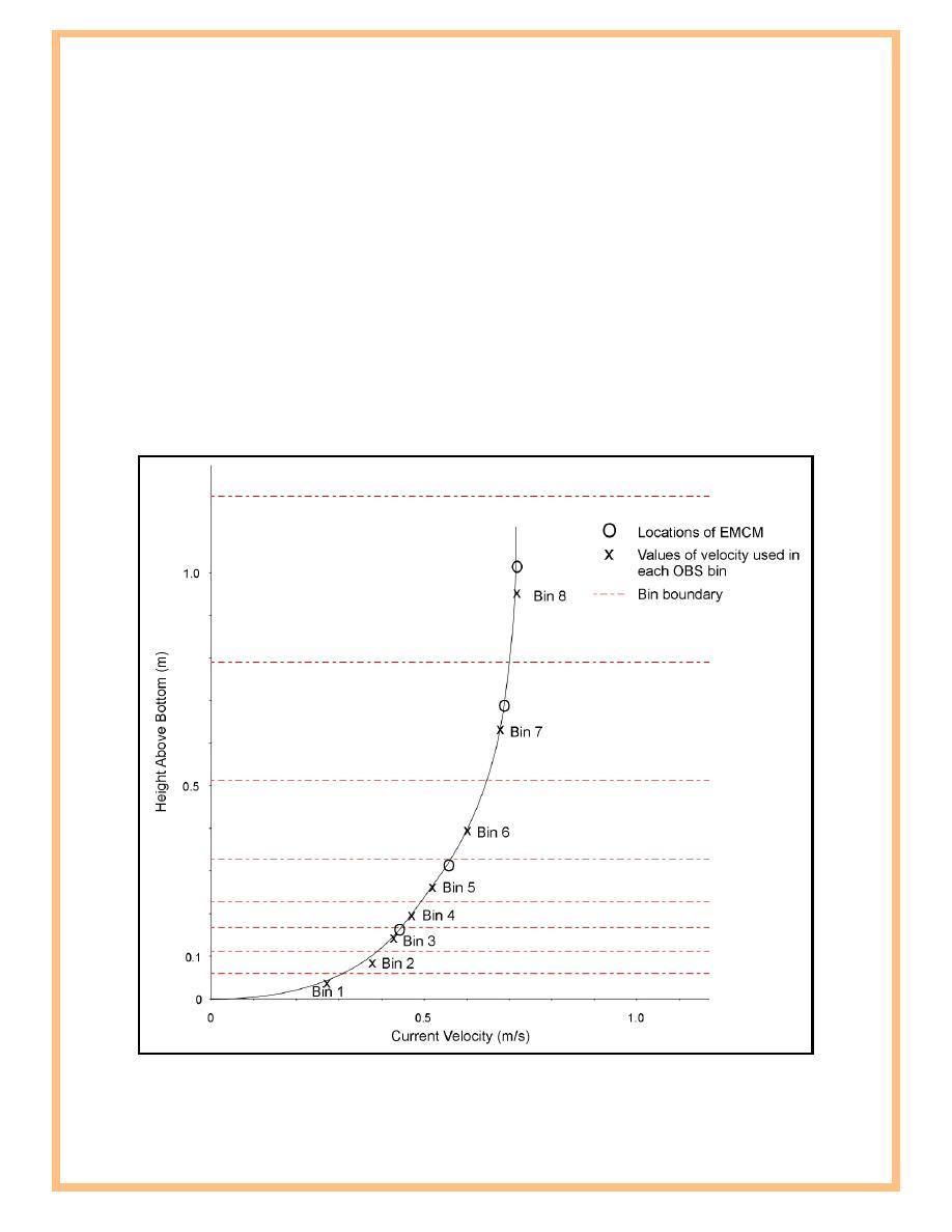
bed/water interface and the upper bin top boundary will be the air/water interface. The EMCM,
which may or may not correspond to OBS location, can be interpolated to provide a current
value for each bin (Figure 4). Any bins where noise dominates the signal should not be included
Figure 4. Interpolation of EMCM to OBS bin locations
9


 Previous Page
