
b. After closure, September 1995. Closure was completed in December 1994.
Figure 7. Grays Harbor Washington breach area.
Coos Bay, Oregon. Coos Bay is an estuary on the Oregon coast about 200 miles south of the
Columbia River mouth. The entrance is enclosed by Coos Head to the south and a low sand spit
on the north. The entrance is stabilized by rock jetties on both the north and south sides of the
entrance. A 47-ft deep channel extends between the jetties. Coos Bay is the largest deep-draft
harbor between the Columbia River and San Francisco, CA, and is one of the largest shipping
ports in the world for timber products.
Similar to Grays Harbor, the shoreline on the bay side of the north spit receded as a result of
inner bank erosion following the construction of the north jetty. The ocean shoreline also
receded as a result of transport directed offshore near the north jetty. In addition, the navigation
channel migrated to the north, eroding the interior shoal that supported the base of the jetty and
exposing the landward terminus of the north jetty to increased wave attack. Return flow from
wave runup on the shoreface and overtopping of the north jetty formed runnels along the base of
the jetty. These factors weakened the north jetty and culminated in a breach of the north jetty on
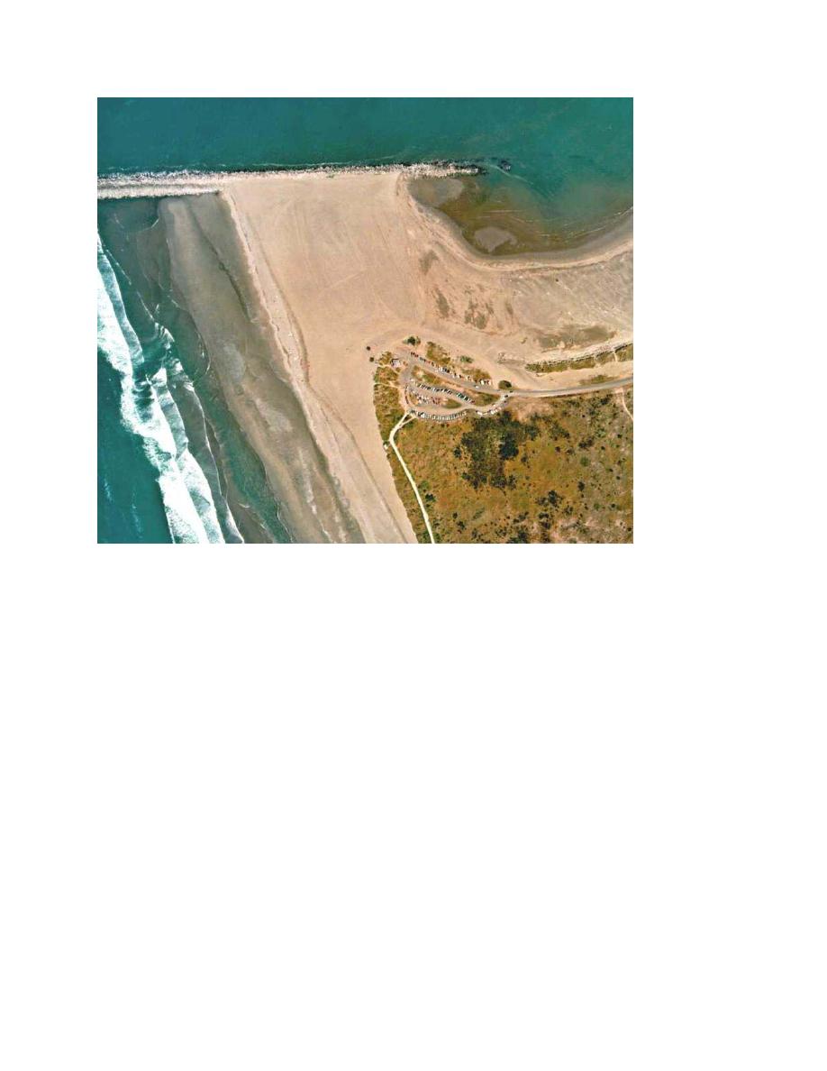
8 November 2002 during a storm with offshore waves in excess of 8.7 m in height and 17-sec
period. The landward end of the jetty was breached, not the barrier spit (Figure 8). The waves
approached from the west-southwest and directly attacked the landward terminus of the north
13


 Previous Page
